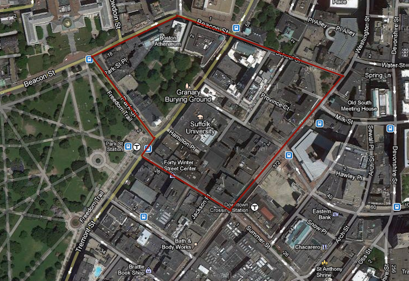
 Satellite view of the Park Street/ Downtown Boston area from Google Maps
Every city, from its inception, is shaped by the natural environment and process around it. Though it may seem that there is little nature to be observed in the city of Boston, it is no exception to the influences of nature. As Spirn points out in The Granite Garden, “…nature in the city is far more than trees and gardens, and weeds in sidewalk cracks and vacant lots” (Spirn, 4). Within the city, there are many signs of the natural processes that are an ongoing part of the city. In the more populated, high traffic parts of the city such as the site I have chosen study (the Park Street/downtown area), these signs are subtle and not easily spotted. However, upon close observation, one can see aspects of nature, such as the plants, topography, animal life, etc. within the concrete jungle. After such observation, it becomes evident that the city has been shaped and will continue to be shaped by natural processes; and in turn, the city has “[modified] the natural environment” (Spirn, 12) shaping the natural processes.
When assessing the natural processes shaping an area, the history of the area is an important context to consider. In the case of the Park Street/downtown area, the history of the site has a vital component of how the city has developed. When the city of Boston was established in the seventeenth century, the area that is now downtown, Boston made up a large part of city. This meant that many buildings, which are now considered to be historical, were built on that land. As a result, when the surrounding marshland was filled, the topography of the area was not changed. To this day, Park and Beacon Street, along with the many side streets within the site boundaries, have maintained their inclined geography.
Figure 1. Map of Boston from 1722 from bostonbyfoot.org. The Granary Burying Ground can be seen next to the Common where the red star is located.
Another part of the region that has remained nearly unaltered for centuries, is the Granary Burying Ground located adjacent to the Park Street Congregational Church. This burial ground can be found on a map of the area in 1722 (Figure 1). Today, it is the only green space within the boundaries of the site I have chosen. Because it has been preserved as a historical part of the city, the plant life (grass, trees, etc.) has also been preserved. Aside from the Granary Burying Ground, however, there are only a few intermittent signs of plant-life in the area.
Some of the more noticeable of these signs of plant-life are those that have been planted for aesthetic purposes and seem to be thriving. An example of this is located at the Irish Famine Memorial. The small area dedicated to this memorial is surrounded by plants that seem to be well cared for and thriving (Figure 2). Not only do these plants look as though they are being well cared for, but they are also getting a lot of exposure to sunlight because the memorial is in an open space, away from the shadows of nearby buildings.
Another example is the front of the luxury condo complex located at 45 Province Street (Figure 2). These plants, much like those at the Irish Famine Memorial are green, thriving and add an aesthetic appeal to their surroundings. Unlike the plants around the memorial, however, these plants are directly under the high-rise tower of the condo complex. Despite this fact, they manage to get a decent amount of sunlight because they are facing east. Also, the buildings across the street form them are not tall enough so as to cast them in shadow during the times that the sun is in the eastern part of the sky.

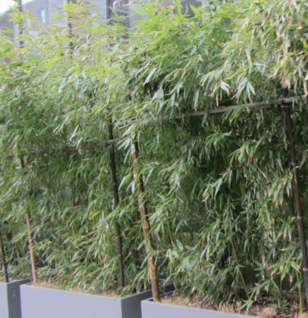 Figure 2. Left: Plants around the Irish Famine Memorial. Right: Potted plants by the 45 Provence luxury condominium complex.
In addition to these examples of plant life, which are primarily bushes and small plants, larger trees can be found intermittently along sidewalks. These trees are currently bare and have no leaves due to the season. Despite this lack of green, one can still see that only a few of the trees are thriving. This is likely due to the “hostile” and “stressful” habitat provided by the city as Spirn explains in The Granite Garden. Many of the trees along the sidewalks are planted on very small plots of soil, usually bound by metal grates as seen in Figure 3. This constriction of the area in which the trees are allowed to grow likely has stunted the growth of these trees. A lack of sunlight exposure is also evident in the progression of the height and overall size of the trees. This is seen in the trees along Washington Street adjacent to the Irish Famine Memorial (Figure 3).
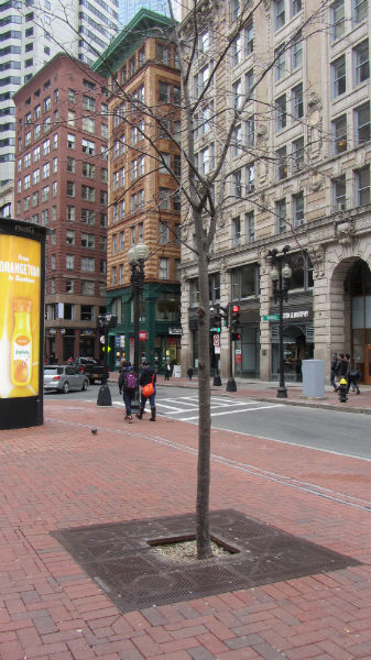
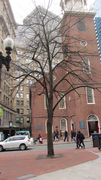 Figure 3. Left: Stunted tree that gets minimal exposure to sunlight. Right: Tree located a few yard from tree on left but is much larger due to better exposure to sunlight.
Though there are many more examples of stunted trees than thriving ones within the Park Street/Downtown area, there are still a few examples of large, healthy trees. Many of these trees are found within the Granary Burying ground where there is ample open space and nutrient rich soil. This means the trees are able to get the nutrients they need as well as expand their roots. A few of these trees have even expanded their roots to the point where the roots are growing around gravestones (Figure 4). The fact that they are located in open space also means that there are few buildings to block the sunlight. The combination of these factors has allowed for thriving plant life in the Granary Burying Ground.
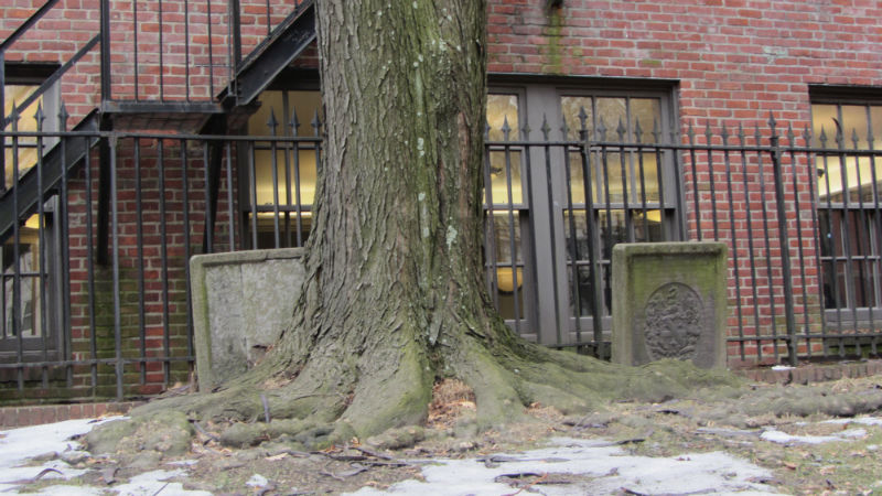 Figure 4: Tree in Granary Burying Ground growing around gravestone.
While there is some evidence of thriving plant-life in the area, it is hard to find much evidence of animal life. Likely due to the high population and traffic of Downtown, Boston, as well as the lack of abundant plant-life, there are very few animals to be found. In fact, the only animal life I observed in the area were birds. There were several pigeons and sparrows around both the Irish Famine Memorial and Park Street, which boarders the Boston Commons (Figure 5). These birds are likely found in these specific parts of the site found in these specific parts of the site because that is where people have fed them, despite the signs around the Famine Memorial that asks that people not feed the birds (Figure 6).
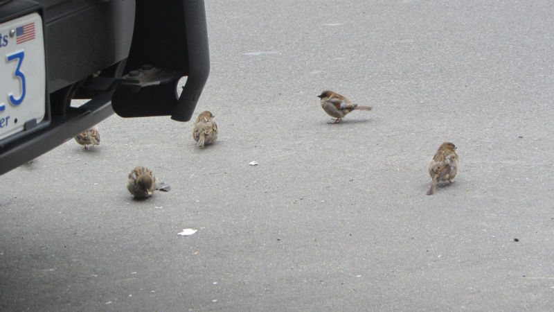
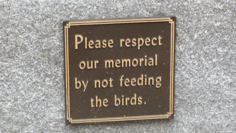
 Figure 6: Sign at Irish Famine Memorial asking that people not feed the birds.
Aside from the plant and animal life, there are still other natural processes that play a role in shaping the city and in turn are shaped by the city itself. One of these aspects of nature is sunlight. The presence or lack of sunlight within the city of Boston, particularly the Downtown area, is a direct result of the structure of the city. Parts of the site that are more open, such as public squares and wide streets with few high-rise buildings lining them, tend to get more sunlight. Examples of such areas include the square where the Irish Famine Memorial is located, Park, Tremont, and Washington Streets, and the Granary Burying Ground. In contrast, more dense areas, such as narrow streets lined with many high-rise buildings, tend to be cast in shadow and get little exposure to sunlight. Much of the area within the boundaries of my site is an example of this, particularly Winter and Bromfield Streets.
Though sunlight is something that has been discussed in relation to plant growth, it is also important to understand that the presence or lack of it has other consequences on the structure and look of the city. One of the more noticeable of these consequences is the effect on the microclimate of the area. For example, the areas that get more exposure to solar radiation tend to be warmer, while those that get little exposure tend to be cooler.
In a place like Boston where accumulation of snow and heavy rain are common, these microclimates seem to playing a role in the pattern of erosion and freeze-thaw damage. In parts of the site where sunlight is readily available, snow that has accumulated melts more quickly and finds its way to drains along the streets. In areas where there is little sunlight, however, the snow does not melt nearly as quickly. The little that does melt is likely to go through cycles of freezing and melting, leading to freeze-thaw damage along sidewalks and streets. I make this hypothesis due to the fact that the roads and sidewalks that seem to be most eroded and damaged in and around the site seem to be those that are under shadow for a majority of the day such as Bromfield Street, Beacon Street, and parts of School Street.